-
OTAKI FLOODPLAIN MANAGEMENT PLAN for the Otaki River and its environment
alarm Published 01 Jun 1998 -
-
The Ridge Track - Kaitoke Regional Park
The Ridge track is a moderately demanding 10 km walk through mature
beech forest and regenerating native bush. The track links the two
entrances of Kaitoke Regional Park and gives…There is no digital version of this document available, but you can get in touch with publications@gw.govt.nz to get a copy of the document.
alarm Published 01 May 1998 -
Queen Elizabeth Park - Sea, sun, sand...yours to enjoy
Queen Elizabeth Park covers 647 hectares of coastal land between
Paekakariki and Raumati South. Its easy access, safe swimming beach,
open country and picnic facilities make the Park…
alarm Published 01 May 1998 -
Mountain Biking - Battle Hill Farm Forest Park
The 500 hectare Battle Hill property provides for a mixture of farming,
forestry and recreation activities. Car parking, toilets, camping and picnic
facilities are available.
This brochure includes details of mountain…There is no digital version of this document available, but you can get in touch with publications@gw.govt.nz to get a copy of the document.
alarm Published 01 May 1998 -
Mountain Biking - Akatarawa Forest
Native and exotic forests cover the hill country between Upper Hutt,
Pauatahanui and Paraparaumu. This vast back country area is managed
for multiple purposes timber production, maintenance of water…There is no digital version of this document available, but you can get in touch with publications@gw.govt.nz to get a copy of the document.
alarm Published 01 May 1998 -
Mountain Biking - Rimutaka Incline Recreation Area
The Rimutaka Ranges northeast of Upper Hutt divide the Hutt Valley from
the Wairarapa Plains. Most of the land on the western side is managed by
the Wellington Regional Council,…There is no digital version of this document available, but you can get in touch with publications@gw.govt.nz to get a copy of the document.
alarm Published 01 May 1998 -
Mountain Biking - Tunnel Gully Recreation Area
Tunnel Gully Recreation Area is part of the Pakuratahi Forest that covers
the western side of the Rimutaka Ranges north of Upper Hutt. The forest
includes both production and protection…There is no digital version of this document available, but you can get in touch with publications@gw.govt.nz to get a copy of the document.
alarm Published 01 May 1998 -
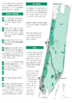
Legal Access to Waterbodies and their margins in the Wellington Region
The purpose of this project is to identify the extent of legal public access to
regionally significant water bodies and to determine ways in which the
Council should encourage this…There is no digital version of this document available, but you can get in touch with publications@gw.govt.nz to get a copy of the document.
alarm Published 01 May 1998 -
Superbus services: an overview of opportunities
Booz-Allen & Hamilton (NZ) Ltd was engaged by Wellington Regional
Council to investigate the potential for new/improved bus services which
would have a primary focus of attracting people…
alarm Published 01 May 1998